Saturday, May 12, 2012

Under The Volcano

At high latitude and high elevation it really is winter here. There were significant snowbanks at the roadside as we climbed up and over the pass this morning. Some really nice twisties also presented themselves on good road, but the cold temperature rendered the road surface as well as my reflexes a bit untrustworthy so I held it back somewhat.

It ain't summer yet!

I have been warned about icy roads, rough roads, tsunami, wind gusts, steep hills, landslides, even earthquakes. What next! And really, what are we supposed to do with that?

On the morning of Sunday, May 18, 1980 my colleague Barry Duguid and I were bussing our students back from a science field trip on the west coast of Vancouver Island. As we arrived at Departure Bay everyone was abuzz at the news of the explosion of Mt. St. Helens. It was expected, but the nature of the eruption was rather atypical. Most volcanoes don’t blow their heads off. St Helens was demoted from the 4th tallest mountain in the state to the 14th in a matter of seconds. The primary eruptives were pyroclastics (ash and cinders) rather than lava, which was the stuff that led to the burial and preservations of the forest mammals at the John Day fossil site.
Mt. St. Helens. Sleeping.

On average, St, Helens erupts every 125 years. Sometimes pyroclastics, sometimes lava. Two thousand years ago it spewed a large volume of fluid, basaltic lava that resulted in two geological features that we visited today.

Imagine a river of lava that, as it cools on the outside surfaces, forms a solid crust on the top, bottom and sides. Meanwhile the interior is still a hot liquid which eventually drains out, leaving what looks like a hollow pipe called a lava tube. Ape Cave is the local example of such a thing. It resembles a small railway tunnel a few miles in length. While The Bruiser had a little nap in the parking lot, I embarked on a self-guided, underground tour of Ape Cave. Armed with my little LED flashlight I walked about a half mile in utter darkness, and in an environment considerably colder than it once was! My endpoint was a feature called The Meatball, a solid lump that got hung up on the ceiling of the tunnel buoyed up by the underground river of lava. It does look a bit precarious hanging up there and I would think one should be cautious about lingering too long beneath it.

Entrance to a lava tube
The "Meatball".

When I emerged, a busload of 4th graders arrived in the parking lot. I thought that was an excellent opportunity to head for the exit.

This led to a study of a second feature often arising from fluid lava flows, and found just a short distance down the road. When a forest is inundated with basalt, the trees and logs are engulfed and incinerated, but not before the lava hardens around them. Tree casts result. Once the wood disappears, the logs become tunnels and the tree trunks cylindrical holes in the flow.

As the day warmed up, the curvy roads became a wee bit of fun until they ultimately led us to the dreaded I-5. Juiced up on the good stuff, The Bruiser pulled me along in excellent form. This bike impresses me so much with its smooth and gutsy character, forever reliable and a real treat to ride. He is nimble in the corners (not so much in the gravel, although he got a bit huffy at my ‘hippo in spandex’ remark) and steady on the straightaways. Thank you, Bruiser, for your stalwartliness and dependability as we covered 1/3 of the earth’s circumference in the last seven weeks.
The rainforest

Beginning of the Last Leg

Personally, I have about hit the wall. I have had the experience of a lifetime and I am most fortunate to have had the opportunity and the wherewithal to pull it off. But I am about done. I would need a good pause right about now before I could do much more.

Initially I considered a motel in Seattle tonight where I will meet Brent at noon tomorrow. Truth is, I much prefer the outdoors. So after buying myself a new air mattress (my ass hit the ground at midnight last night) we established ourselves at Millersylvania State Park near Olympia. It is busy and noisy as the first hint of summer has arrived for the weekend. I treasure my solitude, but quite enjoy the energy of this place this evening.

My neighbour is a good fellow with plans for some great and ambitions adventures in life, but who must first climb some hurdles with chemotherapy.

Opportunity and wherewithal….

Good fortune and adversity are not evenly disbursed.

A Chilean cab is going down rather well. There will be none left for breakfast.


Friday, May 11, 2012


The accelerated rate of escaping air from my mattress is putting my butt on the ground at about 4:00 AM now. I have gained the temerity to tough it through, but not with the squawking of crows, pheasants, pigeons, roosters...and so help me, a bloody goose walked right around my tent at sunrise honking like a New Delhi taxicab. So I got up early.

And it was cold. But when I reached the campground near Fossil where I had originally planned to spend the night, the temperature was 6C lower, so I had called it right. That would have frozen my bottles.

I love that little town and have visited it several times in my biker travels through this area. The Timber Wolf Restaurant has the worst coffee I have tasted and the food is horrible, but it is the social epicenter and I enjoy listening to the local banter and relentless teasing among old friends. I had a single pancake about the size and weight of a hubcap and struggled with it for much of the day.
Downtown Fossil. At rush hour.

Fossil is a fossil. Its infrastructure is circa 1910 and it appears, on the face of it, to be a fully functional little town.. The City Hall, Public Library and Fire Department share the same small, single story building. The Mercantile has been selling everything you would ever really need since 1903. Everybody greets everybody by name.

Fossil also has fossils. Just behind the sports field of the little high school is a fossil locality in an outcropping of shale that visitors are invited to chip away at. There are even rock hammers made available for you if you are so disposed. 
Plant fossils are found against the hill behind the soccer pitch at Weaver High School.

I spoke over the fence with John the custodian as the kids practiced their track and field events. The town is shrinking, he said. School enrollment is currently 38, down from 400. Lumber operations are closed due to the successful efforts of the environmentalists to save the spotted owl. Ranching is the mainstay of the area, but that is about it. I did see several homes for sale in town, and there are not many homes to start with.

This way or that way? A single choice changes the journey. At an intersection at Fossil I turned in what was not my intended direction and went north instead of west. So this blog would otherwise have had a far different ending. Funny, that.

Windmills line the hills on the sides of the Columbia River. Hundreds of them! In places, as far as the eye can see.
The Bruiser say, "Hey! Look at me! I'm Don Quixote!" He's pretty funny for a Suzuki.

I crossed the big river at Biggs, and followed Hwy 14 on the Washington side west to Carson. It was quite a beautiful ride. Wildflowers were in full and dramatic bloom on the roadside. Recreational water sporters were fishing, sailing, and windsurfing all along the river’s course. Vineyards are greening up in preparation for this year’s vintage, and the rocks—oh yes, the rocks!—were splendid.
The Mighty Columbia River. In the background, Mt Jefferson, one of the 13 volcanoes in the Cascade Range. In the foreground, next year's wine.

Sequence of lava flows making up the Columbia Plateau.
Let me tell you more about that. About 15 million years ago, about the time that big magma chamber was moving east relative to the North American Plate and spitting out volcanoes right, left and centre, a series of eruptions in eastern-central Washington spilled out layers of very fluid lava called basalt. Basalt is the stuff that spews out in Hawaii. It is very fluid and forms lakes of lava rather than mounding up to form volcanic mountains. As many as 300 flows formed layers of lava almost 2 km thick. The Columbia River cut a mighty gorge through them, exposing many of these layers that are easily seen in cross section along the sides of the river. Had I decided to go east into Grand Coulee I could really tell you a story, but that will have to wait for another time. Or give me a few drinks and I’ll tell you anyway.
A collaboration of rocks and flowers

As we approached camping time, we steered inland at Carson and sought a humble residency for the evening. Following a sign down a long road to a Forestry Campground called Panther Creek, we encountered a gate across the entrance. Closed? You buggers! Well, The Bruiser is nothing if not nimble, so we squeezed around the gate (don’t read this, Kids) and installed ourselves at a most secluded little site in the heart of the west coast forests. A beautiful blue river gushes nearby, and with a preponderance of firewood I had the first campfire since someone gave me a Presto Log in the bayou of Louisiana.
Camping the way I like it in the Pacific rainforest. Without the rain.

The Bruiser and I have but a single day more of exploration of the world within our scope and grasp before meeting up with my son-in-law, Brent who will escort me home (circuitously) from Seattle on Saturday. It is with a curious mélange of relief and regret that I must end this soon. I will soon have to occupy myself with endeavours beyond riding and writing, and you, my faithful followers, will soon need something else to read so help you sleep at night.

But I’m not quite done yet.

Thursday, May 10, 2012


Technology is grand. Using the wireless signal at my campsite last night I found a motorcycle shop in the next town of Ontario, made a computer phonecall, got a map showing where to find it, and badaboom badabing I was set. I showed up on their doorstep at 9:00 and by 10:30 The Bruiser had a brand new rubber boot.
(Now we are both retired. Ha!)
A serious rear tire.  But not mine. :)

 "City Park" reads the sign. A fairly liberal interpretation of both terms. My lunch stop in a cottonwood snowstorm.
Almost every year for the last six when I have taken my solitary motorcycle tour for a week in the summer, I have found myself driving through this area in central Oregon around the town of John Day. It has everything a geologist biker could ask for. The roads are lacquer smooth with sensuous curves and very light traffic. Scenery is colourful and stunning, owing in large part to the outstanding geology. People are down home and friendly, and the history of the place is written in the old homesteads and barns that are in regal decay around every bend.
This place has everything. Scenery, geology and twisty roads. Playland for a geo-biker.


Everything here is named for John Day. A town, a river, a county, and a large hydro dam. It would seem that he is a heroic historical character that figures highly in the formative years of this region. 
Not exactly. The story goes like this.

John Day was a nerdy settler in the pioneer days who was out riding one day and was ambushed by the local Indians. They didn’t scalp him or anything like that. Seems they had a sense of humour. They took his horse and all of his clothing and sent him loose to find his way home barefoot and buck naked. The as yet unnamed river near this alleged incident occurred now bears his name. The town, county and dam are all named after the river, not the frontier dweeb.

The river valley is unspeakably gorgeous. Steel blue water flows through emerald green groves of grass and trees, and the surrounding hills are all the flavours of that gelato place on Commercial Drive. I would have taken more pictures to show you—as it was I stopped many times, and was making slow headway!—but it was just tremendous fun riding through the canyon. I was glad that I decided to change that tire this morning. It was fresh with a rounded rather than a flattened, worn profile, and once I made a few careful turns to scuff the slippery resin coat off the surface of the new rubber we were throwing sparks off the floorboards. This beats the heck out of those flat Texas raceways!
View from a height. The John Day River cuts through the cleft in those hills...


... and looks like this. It is called the Painted Gorge.

One of the most important fossil localities in North America is the John Day Fossil Beds. (again, named for the river, not the dweeb). I would bet that most fossils you have seen are of shelled marine critters. When an organism dies, it is almost always destroyed by decay or scavengers or weathering. It helps if the critter has ‘hard parts’ such as shells, bones or teeth, and if it lived in an environment where it is likely to be buried and thereby preserved. That describes marine shellfish quite well. Landlubbers are not as easily preserved since they are not as likely to be buried and are correspondingly rarer as fossils. The John Day area is unusual because of all of the mammals and land plants of about 20-30 million years ago that were buried, not by water sediments, but by repeated deluges of volcanic ash that followed a multitude of eruptions in this area. 

A collection of fossils at the interpretive centre here displays a variety of early mammals, some of which I never knew existed. There are huge rodents and tiny horses, camels, rhinos, cats and elephants, a great many of which never made it on the Ark.
Fossil skull of huge rodent

The colourful layers exposed on the cliff faces are lava flows and volcanic ash layers, the latter of which buried and preserved fossils of  forest critters.
I decided to camp at a lower and hopefully warmer place than my favourite spot near the town of Fossil. Spray has a population that runs into the dozens, but put a decent little park together near the river.

I made a little friend.A beautiful young border collie cross just came bounding over to me, jumped in my lap, and is engaging me in a perpetual game of ‘fetch’.  So if you will excuse me I must sign off now as I have a pair of big paws on my arm and a stick at my feet.

Wednesday, May 9, 2012


Today was kind of unusual. Nothing startling happened. There was no wind, no rain, no mishaps. I went from here to there on roads that for the most part I have traveled before, and there was a comfortable familiarity to it all. No flat tire, or mechanical surprises. No near death experiences or heart stopping vistas. Nothing life changing or profound fell on me. And as I look back over the last couple of months and 10,000 miles under me, that is kind of unusual.

Does that mean it doesn’t count or is not worthy of writing about? I know that those of the Facebook generation take delight in telling everyone they know what they are doing at each and every moment, however mundane. Is it for the purpose of celebrating the experience of living, or is it a responsibility carried by those in the digital collective? I don’t know. But I am going to put another take on an examination of the ordinary.

We humans have a tendency to want to classify things. In particular, events are either GREAT! In which case we love to expound upon them and exaggerate them and seek to relive them in some way. Or else they are CRAPPY! In which case we like to grouse about them and seek consolation and awe from others and wear them on our pockets like Purple Hearts. What do we do with the other 90% of the life we lead that falls outside these notable extremes? We promptly forget them, if indeed we noticed them at all. How tragic that we consciously ignore most of our waking lives.

Each day I am reminded that everything has an origin and a history. It is changing and evolving, and in the future it will ultimately have its demise, but will persist in the form of its linkages to other things in either profound or subtle ways. I believe that that is equally true for historical artifacts, geological structures, societies, perspectives, and human legacies.

Teachers are in the business of fostering new understandings in the minds of our students. After 36 years of trying my level best to do just that, I had a most interesting conversation with some colleagues and fellow educators at U.B.C. not long ago about “what is the nature of Understanding’” What does it mean to understand something? What does it mean for a concept to be rendered meaningful? In the end, we agreed (although there is still so much to be said on this) that it has to do with the degree to which this new concept relates to previous experiences and personal images and prior knowledge. In other words, something is meaningful if it is connected to ME and things I already think.

Even the mundane is meaningful--especially the mundane is meaningful--if we pay attention to it and ask questions of it and endeavour to forge a network of connections with things we have already experienced.

(Forgive me for pontificating and sharing out loud those things that rattle around in my helmet. These days I have a lot of time to think and nobody at the gas pumps seems to have much time to listen to me on this)!

In the end, nothing is ordinary. Or if we believe it is, we are missing vast tracts of our own lives. In Eastern philosophies, much importance is placed on the practice of “living in the moment”. The past is history and forever unchangeable. Take lessons from it, but accept it for what it was for we can do nothing else. The future is a mystery. One can and should anticipate and plan intelligently, but realize that disappointment is on the flipside of expectations. A journey can be planned, but never accurately anticipated. (I have lots to say about that!) It is this moment in which we live and it would be a shame to waste it. As one of the Eastern masters once said, “when you drink your tea, just ...drink your tea”. In other words, don’t use this moment to regret and rethink or hope and anticipate. Take this time to taste it, sense it and remind yourself that you are alive in it. It is really the only thing we have. I am trying hard to put this into practice as I roar through these ever changing landscapes at highway speed.

There was a bit of freeway travel as we got ourselves to Boise. I quite like that town. It has some wonderful, colonial style homes and funky downtown area. The Boise River flows right through the middle of the city, and in the summer time legions of leisure-seekers delight in drifting down it on anything that floats. None of those were seen at this time of year, however. It was a pretty angry looking river that was overflowing its banks.

We followed the back roads out of Boise, heading for the state line. My visit to Idaho was quite brief this time. Two years ago The Bruiser and I explored it in considerable detail, and especially enjoyed time at Craters of the Moon, a not particularly ancient series of volcanic events fed by the same pot of magma that formed Yellowstone, Valles Caldera and the ash layers in which the Peubloeans carved their dwellings near Los Alamos. Those blasts in southern Idaho created a most remarkable landscape. I camped one unforgettable night nestled in the middle of something quite other-wordly.

Idaho is renowned for its potatoes. They even have the message “Famous Potatoes” embossed on their license plates. This must surely be embarrassing for many who would prefer that they be renowned for something else. For example, Idaho is developing a respectable wine industry that I had occasion to study last time. And they also have very friendly and helpful State Troopers to which I can attest. I think that would look good on a license plate. “Idaho-Good Wine, Nice Cops”. Whadyathink?

The elevation is down to a sensible 2000 feet now that we have climbed down off the Colorado Plateau. It is correspondingly warmer, more seasonal, and (hopefully) the nights will not be so painfully cold.
One branch of the family made it big in Emmett, Idaho!

Geologically, (sorry, it is that time again) the plateau that covers much of the region of Colorado, Arizona, Utah and New Mexico resulted from a massive tectonic uplift some tens of millions of years ago in which the landmass was raised almost as a single, unbroken slab by about a vertical mile. The Colorado River, already a well established river with a meandering course at the time this began, maintained its position as well as its elevation as the slab slowly rose. The result is the Grand Canyon, a deeply entrenched and meandering river valley. If valley formation is like a knife cutting into a brick of butter, imagine the knife staying put and the butter being lifted up into it.
A volcanic feature near Vale, Oregon

We crossed into Oregon in late afternoon and arrived at a campground in Vale that I visited and enjoyed when I was through here last. I took advantage of the wireless internet that I can pull down from my campsite and made some tentative arrangements to have my rear tire replaced tomorrow. You may remember that the thing was brand new when I started this trip many miles ago!
Who would think that a town with the name of Ironside could be so serene?

The sun is now a fireball on the horizon. The internet is streaming me some good blues, and the sound of howling coyotes—the call of the Wild West--has been replaced by that of a single bleating cow. There is not a buzzard in sight.

Tuesday, May 8, 2012


Evidently, coyotes have found their way to this little island as well. The local contingent were in good voice last night as they paid their tribute to a full moon that will not be as big as this for another 500 years.

Another windy one this morning! It is merciless and relentless.
Pack this!

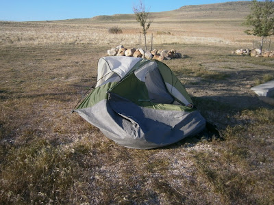
I felt like a one-armed vagrant as I gathered up my paraphernalia of the homeless and stuffed it clumsily into my shopping cart as that unrelenting wind tried its best to wrest it from me..

I resolved to put 300 miles behind me today and succeeded. But I’m bagged. Bought myself a stiff drink to end the day with (sorry—“with which to end the day” because I know that a preposition is a bad thing to end a sentence with J

One really needs to go out of the way to sidestep the interstate freeways, but I did my best. Turning east on 83 from Brigham City we cruised through range land with small rocky hills on one side and small briny pools and salt pans on the other.
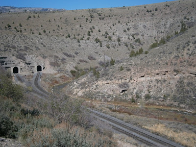
The "No Trespassing" sign hanging on the fence is hardly necessary.

The cattle here must surely suffer from hypertension and bloat and I imagine their meat is marketed as ‘pre-salted’.

ATK is a rocket manufacturing facility for NASA and the military. Some of their products were put out on display. It is really out in the bugger-alls with no habitation within, well, exploding distance. How satisfying it must be to be able to parade around in a teeshirt that proclaims, “As a matter of fact, I AM a rocket scientist”. But I suppose if they are all rocket scientists the gag value would be compromised.


Another sidestep was an ambitious one: Hwy 30/42 from Snowville, Utah to Burley, Idaho. The Bruiser and I stopped and studied the sign proclaiming “No Services for 102 miles” before taking a deep breath and forging on. The sign turned out to be less than accurate—it was only 70 miles—but the road was meditative run for about an hour and a half. There was no appreciable change in elevation, temperature, scenery, speed or direction, It was an opportunity to think and absorb where I was in time and space. I was not concerned about going to sleep. (Someone in a parking lot asked me recently if I ever fell asleep driving this thing. I replied, “If I did I wouldn’t be here to answer that question”.)

I thought about the themes and contrasts that have presented themselves to me over the course of this trip. Notions of adventure and convention; change and stasis (and I have come to appreciate that there IS no stasis!), home and away, solitude and dependency, evolution and extinction, tolerance and indifference, natural and commercial, and so on. More will come to me. Good and bad is not among them. Even the rampant and inescapable corporate message to the consumer has to be acknowledged. We have seen what happens to communities over the centuries when resources and needs become out of sync with one another,

Twin Falls, Idaho has a truly amazing set of waterfalls that needed to be seen, photographed and reported. Fees are collected now at virtually every tourist site.
“Do you have a senior’s card?” I was asked by the attendant who was trying to find a reason not to charge me for just going in for a picture.
“Nope” I sez.
 “How about military service?”
“I was a school teacher for 36 years”, sez I. “Does that count?”
 “Close enough”, he responded, and waved me through.
Shoshone Falls

Back on the interstate aiming for a state park, when something quite unexpected happened. The fuel light came on, indicating that I was nearly out of gas. Bewildered, I considered a variety of possibilities. You see, The Bruiser has no fuel gauge, so I just have to calculate how many miles/km I have remaining after a fill up. By my reckoning I still had 100 km left. Did I screw it up somehow? Ah, perhaps the idiot light is malfunctioning. That must be it.

And then The Bruiser sputtered to a stop.

Nope.  guess there is nothing wrong with the indicator light.

Evidently in my haze of many miles, dehydration and low blood sugar I did indeed screw up. In any case, according to the road signs and my GPS, I was about 3 km from the next gas station. So I pushed The Bruiser along, hoping that the next downhill gradient would be enough to coast us within striking distance. It wasn’t. After about 1 km I was done. And more than a bit disappointed that not one of the hundreds of cars that blew past a grey-headed old fart pushing a heavy motorcycle along the side of a freeway thought to stop and offer assistance. I was reluctant to park it on the roadside, because in my experience, freeway traffic is not as likely to ignore a vehicle full of unsupervised loot at the roadside.  Just then, guardian angels disguised as State Troopers pulled up, splashed some fuel in The Bruiser’s tank using a fuel line pump from their cruiser, and sent me on my way. 

Thank you.

So here I am at Three Islands State Park. As I look out my back door I see an old trail scar on the hill that a fellow camper pointed out to me is none other than the remnants of the Oregon Trail. It is the local equivalent of the Nachez Trace I saw in Mississippi that channeled the early pioneers to their chosen Promised Land by horse drawn wagons (the forerunner to the Hummer). 
Can you see the trace of the Oregon Trail? There are two. I guess one is the passing lane.

Monday, May 7, 2012


Short miles today. Actually, the plan was to go for some big, relocating miles, but it was a miserable and sleepless night, I had a late start, and what little time I was on the road was exhausting and quite unpleasant. I-15 through Salt Lake City and all of its neighbours that sprawl to the south and north is big and badly surfaced, but it is Sunday and the traffic was fairly light. Howling side winds made it particularly difficult. And the near miss that I have been waiting for missed me, but it was unsettling and it made me want to shorten the ride.
Now there's an idea! Let's harness the horsepower that is trying to blow me off the road!

About ten years ago we roared along this highway and were hell bent to visit the Great Salt Lake. Although it is one of the biggest lakes in North America, we missed it. Almost all of the shoreline is spoken for by industry etc. and there is really only one exit off the interstate that gives access to the lake. I was determined to not miss it this time.

Antelope Island is connected to the shore by an ambitious causeway I measured to be 11 km long. Oddly, it felt kind of comfortable over here probably due to the familiar sea smells and seagull sounds. First stop was a rocky point that is a rookery for the California seagulls who have adopted this pseudo-sea as their home.
Great Salt Lake from Antelope Island. To the right is the long connecting causeway.

Rookery for California gulls.
I had a pleasant walk on the sandy shore, wading out to get wet just to say I did, but stopped short of testing the buoyancy of the hypersaline water. One would have to walk out a considerable distance to find water deep enough to submerge in it. I did have a taste, however, because I knew you would ask. And yes, it is… like TOTALLY salty (as the kids would say). Dude.

There ya go!

The water is so dense that birds can actually walk on the surface of it. ;-)
OK, it is time now for a little geology lesson, Boys and Girls. Listen up.

Surface water typically collects into streams and rivers as it seeks a lower elevation.. But if there are some irregularities in the gradient such that the water pools up in basins, a lake is formed. Once the water level of the lake becomes high enough, it overtops the basin and a new river is created by the overflow. Ultimately the water reaches the lowest elevation, i.e. sealevel, at least most of the time.
However, the basin up here in the highlands of Utah is so big relative to the amount of water available to fill it, that the water evaporates before it gets deep enough to overflow. Stream water also contains very dilute amounts of dissolved salts from the rock and soil it washes over, although it is seldom salty enough to notice or even to taste. These salts are carried to the lake basins as well. But when the lake water in a landlocked basin evaporates, the salts remain in the lake and the salinity steadily increases over time. In other words, the water gets recycled by evaporation, but it is a one way trip for the salts. Hence and behold, the Great Salt Lake. (Incidently, oceans are saline for exactly the same reason).

After a relaxing time on the beach, chatting with people here and there, and having a nice hot shower I noticed it was about camping time. Being rather disinclined to saddle up again and head off to find something somewhere, I elected to park my butt at the campground right here on the island.  It is peaceful and serene and I have a commanding view of the lake from this little hilltop.
Camping at Great Salt Lake
Heathcliffe is perched on the table beside me in the faint hope that I have a hand out for him, and some very pretty, lemon yellow bird is warbling away on the tree behind me.
Hey Buddy--spare some change?
And a buffalo just walked by.
I was not expecting that.


Sunday, May 6, 2012


Let's talk about wine.

I like wine. It is tasty, pleasurable, and among other things it is a powerful metaphor for some important things.

“Sideways” was a movie based on a wine metaphor. Two reprobates are swilling their way through a wine region of California and during one lucid conversation the point was made that one can never, ever have the same wine twice. Even if it is made from the same grape, from the same vineyard, by the same vintner, and in the same year, a bottle changes daily as it ages and the conditions of temperature, humidity and other environmental factors will make each bottle completely unique. Even with the same bottle, the last sip is chemically different from the first one since it starts oxidizing as soon as the cork is pulled. It implies that wine is a metaphor for the uniqueness of every individual, and that we are each a product of our nature, our nurture, and the passage of time.

That, among other things, was rolling around in my helmet as The Bruiser and I spun along the Colorado River on Hwy 128 out of Moab, and happened upon a winery and vineyard on the riverbank. I stopped for an obligatory picture but not for the tasting. Although given the colour of the rocks and soil  I’ll wager they specialize in reds.

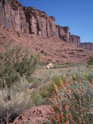
Now I will tell you that this particular road was astonishing  in its beauty. Yes, I know. On this platform I have raved on about my encounters with astonishingly beautiful scenery on numerous occasions, but let it be said that this one was a stunner. The Colorado River that cut the Grand Canyon and the one that is carving out this one are one and the same. We are upstream of the Grand Canyon here and one could think of this as the mature adolescent (is that a contradiction in terms?) of what it will grow up to be a few hundred miles farther on. Burgundy red sandstones and shales are laid open in the deep, steep canyon walls. Priceless!
Baby Grand

I sort of imagined myself at the bottom of a glass of red wine as the walls of the canyon climbed up on either side of me. And what a splendid wine it was! The shear beauty of it was intoxicating enough. Around every curve there were different and splendid nuances to be revealed and savoured. Indeed, the character changed so much it was as if the Barolo was transformed to Amarone and then to Ripasso. All magnificent,  each  different.

Excellent wines—even just decent wines—are to be sipped and savoured rather than guzzled. Time should be taken to sense and study the aromas and flavours as well as to share and talk about the experience with others with deliberate and reflective countenance. Enjoyment of good wine, therefore, is both a personal and a social experience. Further, the ambiance of the setting, the pairing of foods and music and physical surroundings is inextricably linked to the experience of the wine tasting. At the end of the movie “Sideways”, we see the lead character drinking an extraordinary wine from a paper cup in Burger King. That is just wrong and for so many reasons!

My point is that my experience in the canyon today was like an extraordinary wine. But I drank it quickly and alone. Now Bruiser, don’t get me wrong. You are a good companion, although your conversational skills are rather limited and you won’t drink anything that isn’t 88 octane or higher.

There are many ways to savour the canyon.

One could float down on a raft or kayak.

On horseback.

On bicycle.
The Moab elite cycle in style.

The price paid for that exquisite diversion in an easterly direction was a few hours on an interstate through barren scrub to get me back on the homeward track. Eventually it led to a nice little river canyon that carried us up into the hills.


The “historic little town of Helper” offered, I thought, an interesting side trip. Once a mining and railroad town a century ago, it has become an architectural remnant. We have seen this so often! The historic buildings on the main street are all vacant aside from a coffee shop and two art galleries, both closed today (Saturday). You know a place is moribund when its tavern and State Liquor Agency are boarded up. It seems like all the little towns are doomed to replicate the destinies of the Puebloean cultures. Years from now the tourists may be drawn to places like this with signs announcing “Historic Ruins of Helper Village”.
The little town that was.

But, you know, marketing is everything. Rethink your street names!

I suspect the opening of a Walmart in the neighbouring town of Price may be linked to its demise.

Funny thing about roadmaps. Information is limited to direction, road quality, and often the aesthetic value as indicated by little dots printed beside the ‘scenic routes’. As you know I much prefer secondary roads with scenic enhancement, so I charted my course to Salt Lake vicinity accordingly. What they don’t usually tell you is the elevation.

Consequently, I experienced three seasons today. Stinking hot in Moab like the hottest of summer days. Climbing up towards Schofield State Park the leaves vanished from the trees as we reversed in time to early spring. Aspen were in very early bud, birch were naked, and the grass was not yet greening up. By the time I reached Schofield it was brisk indeed. I asked the ranger guy what kind of temperature I could expect camping here tonight and he reckoned it would be at or near freezing. GPS reported nearly 8000 feet.
Winter at 9000 feet.

We gotta get outta here before it gets dark. So we set in a course for somewhere lower and presumably warmer. However, the road out goes up before it goes west. Signs advise motorists to carry snowchains up until April 30. (Hmmm… that was five days ago). We ultimately peaked out at 9500 feet., Thankfully, when winter descended upon us the snow was on the ground rather than falling from the air. It did make for rather beautiful scenery, I must say. In an alpine kind of way. But man was it cold!

It was fascinating to watch the calendar advance from spring to summer as we descended again. In the course of a 4500 foot descent the tree buds exploded into leaves and ground vegetation spit out yellow flowers.

An hour before sunset I scored a great little Forestry campground beside a meandering brook, nested in the green hills.

But it was too cold to sleep. In the morning, my water bottle was a block of ice and I could not feel my feet until about 9:00 AM. 

I wonder how the campers at Schofield fared last night?